
Geophysical Services
Summit's Geophysical Services and growing geophysics division provide a full array of real-time geophysical services to the environmental, engineering, and construction industries.
Our multi-faceted approach includes:
- Ground Penetrating Radar
- Radio Frequency Line Locating
- Electromagnetic Scanning
- Resistivity Profiling
Our combination of equipment and experienced geophysicists enable us to detect private utilities, underground storage tanks (tank sweeps), drums, septic structures, borehole bedrock fractures, excavations, rebar and more.
Summit's geophysical services are supported by one of the industry's largest teams of full-time professional geologists and highly experienced geophysicists with multiple crews dispatched daily. Each crew is equipped with the latest in geophysical technology, including ground penetrating radar, electromagnetic scanning, radio frequency line locating equipment, and high-tech drones.
Our combination of equipment and experience is unequaled. Customers count on us for a wide range of services from near-surface infrastructure detection to precise downhole geophysics and logging. Summit is a trusted source for pre-drilling or pre-excavation clearance, private utilities, underground storage tanks (tank sweeps), drums, septic structures, rebar, landfill and buried waste delineation, karst terrain and bedrock mapping, and electrical resistivity profiling. Our multi-faceted geophysics division provides a full array of real-time geophysical services to the environmental, engineering, and construction industries.
For more information on our multi-faceted services approach, email Lauren DiVello at LDivello@summitdrilling.com. You can also use our convenient Start-a-Project form below to provide details about your scope of work and upload reference documents. A Summit representative will respond promptly.
Explore Our Geophysical Services:
 Utility Locating
Utility Locating – Prevent accidents and protect critical infrastructure!
Utility locating is a critical process that helps prevent accidents, protect the environment, and ensure the efficient and safe execution of construction, excavation, drilling and maintenance activities.
Our Utility Locating Capabilities >> UST & Septic Detection
UST & Septic Detection – Environmental protection starts underground!
The importance of locating USTs or detecting septic systems lies in the prevention of environmental contamination, protection of human health and safety, adherence to regulators, and potential cost savings.
Our UST & Septic Detection Services >> Borehole Geophysics
Borehole Geophysics – Characterize subsurface conditions with precision!
Borehole geophysics is a valuable technique for characterizing subsurface conditions and obtaining data for a variety of geological, hydrogeological, and environmental applications.
Our Borehole Geophysics Capabilities >> Electrical Resistivity
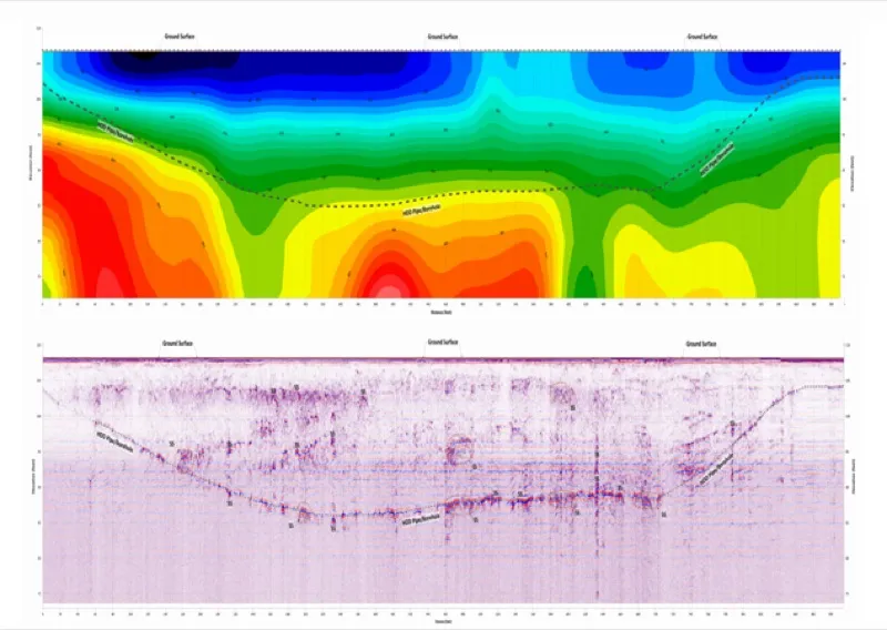
Electrical Resistivity – Map the subsurface with electrical measurements!
Electrical conductivity and resistivity measurements provide valuable information about the subsurface properties of materials, helping professionals make informed decisions.
Our Electrical Resistivity Services >> Seismic Refraction
Seismic Refraction – Study subsurface properties with seismic waves!
Seismic Refraction is a valuable geophysical technique used to study subsurface properties and provide insights into the geological and geotechnical characteristics of an area.
Our Seismic Refraction Capabilities >>Summit's Lauren DiVello is a dedicated and experienced customer advocate.
Reach Lauren at 609-238-2815 to discuss your project needs. Or email LDivello@SummitDrilling.com and she will reply promptly.
Start-a-Project
Quick Response Proposal Request Form
(Please check all boxes that align with your Request for Proposal)
